
The beginning of every project is crucial. The initial planning and procedures determine the direction in which the project will progress, which will also significantly influence the time, cost, quality, and several other important parameters of a construction project. The set of initial surveys in a project is one such determinant that ensures the following:
- Assessment of the site’s compatibility with the type of project proposed
- Stakeout of reference points for construction using standard coordinate systems
- Determination of the building orientation best suited for the proposed building
- Location of the existing structures and resources that can support the project’s construction
- Analysis of the on-site structures and resources that can be retained for use post-construction
The above checklist is quintessential in determining whether your project is getting the right initial surveys. Read ahead to find out more about the detailed surveying methods.

Too busy to read? Contact our expert team over a quick call and get a clear idea about initial surveying for your project. Click here for more.
- A MANDATE FOR THE IMPORTANT SURVEYS
Understanding The Standard Surveying Methods
Every project is different, but the survey methods aren’t. Some standards methods of surveying are common to all projects, irrespective of their context, typology and other specifications. The most important and fundamental initial surveys are site surveys and geotechnical surveys. While the site survey supports the design of a project, the geotechnical survey supports the earthworks involved in the construction of the structure. Together, these initial surveys lay out a strong base for any construction project, without question.
Eager to know more? Get into the details of these surveying methods below:
- Site Surveys
Site surveys assess the site conditions such as land features, climate etc. and help in determining the most suitable design features such as best access, building orientation etc. It is carried out such that it verifies the site information obtained for the initiation of the project and takes it forward for client approval.
It majorly includes the assessment of:
- Microclimatic features such as solar angle, wind speed etc.
- Land topography
- Existing built structures
- Infrastructure points such as electrical, plumbing lines etc.
- Local acoustics, air quality etc.
- Risk factors such as flood risk etc., among others.
A good site survey is aimed to:
- Document accurate site measurements to support digital design processes such as BIM design etc.
- Locate the obstacles that may affect the execution and maintenance of the structure proposed.
- Suggest design recommendations such as solar and wind-based orientation, landscape plans, building access points etc.
A good site survey follows:
- Proper verification of facility diagram and legal blueprints.
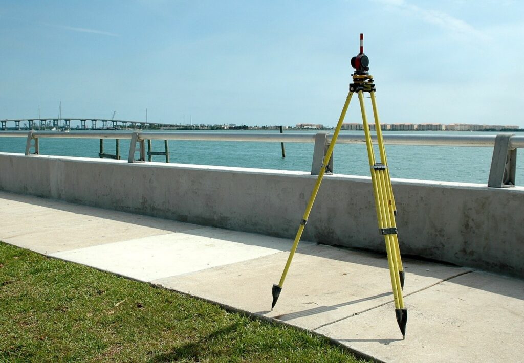
- Accurate identification of land features using latest tools such as theodolites, GPS, 3D or Laser scanners etc.
- A detailed documentation of the survey to support future reference.
- Geotechnical Surveys
Geotechnical surveys assess the surface and sub-surface features with the help of exploration, soil sampling and lab analysis methods of examination. It helps in the initial development of the project by determining the data facilitating the earthwork, foundation and other first-built structural components of a new construction project.
It majorly includes the assessment of:
- Soil conditions such as soil nature, soil bearing capacity etc.
- Groundwater level in the site
- Structural recommendations for the site conditions, among others.
A good geotechnical survey is aimed to:
- Ensure the stability of a foundation
- Prevent human or material damage such as structural collapse, cracked foundation etc.
- Find soil features such as bedrock etc. that can support the structure during natural calamities like earthquakes etc.
A good geotechnical survey follows:
- Accurate and fast modern methods in geophysical examination, photogrammetry and geologic mapping.
- Non-destructive techniques with ground-penetrating radar etc.
- Advanced mapping softwares such as Geographic Information System (GIS) etc.
Unable to find the good surveys mentioned above? Try SSACT
Our team follows the best industry practices for bringing the most desirable outcomes in project management.
- Others
Some surveying methods are designed to add value to the generic surveying process with additional methods to increase the project’s quality and value. Other surveying methods generic to any project include:
- GPS survey—used for mapping and modelling the site landscape.
- Plane table survey—a graphical method used for plotting and field observations.
- Town Planning survey—used for analysing the site’s potential with town planning data.
- Feasibility survey—used for assessing a building’s constructability.
- Land surveying—used for measuring and determining property boundaries that are commonly used as the basis for all property dealings such as buying, selling, mortgaging and leasing.
- Engineering Surveying—used to describe the work of surveyors on civil engineering work that helps construction projects.
- Layout marking or Demarcation survey—used for determining the boundaries of the property. It is considered mandatory to define the square feet area—a part of the selling concepts of real estate owners.
- Contour survey—used to outline a mass of land. It is done prior to the design of the building, by a land surveyor.
- Boundary survey—used to determine property lines and define true property corners of a parcel of land described in a deed.
- Construction surveying—used to stake out reference points & markers, as per a suitable coordinate system, that will guide the construction of new structures.
- Location surveying—used to illustrate any proposed or existing on-site improvements in a particular land area to ensure that all new developments are within the boundaries of the land property and do not block any easements or other regulatory limits.
- Site Planning Survey—used for the preparation of a site plan or other documents which will represent proposed improvements in a given plot of land.
- Subdivision Survey—used to divide a piece of land into two or more lots, plots, sites, or other divisions of land for the purpose of sale of the building development.
- Topographic Survey—used to gather data about the elevation of points on a portion of land and present them as contour lines on a plot.
- A LOOKOUT FOR SPECIAL SURVEYS
Surveying The Context For Different Project Typologies

Every project is unique—it thus needs special survey methods that support the data collected from the standard surveys. These special-case surveys give increased clarity with data and solutions that facilitate the construction of the given project. In general, it is noticed that projects designed for renovation, rebuilding or adaptive reuse require additional surveys of the existing land and built structures, to achieve the best cost and time limitations. This streamlines the management of the project in the most efficient manner.
Do you have a renovation or rebuilding project? Read ahead and find out its special surveying needs.
Too busy to read? Just give us a call and our team at SSACT will give the best expert advice in no time!
- Tunnel surveys
Surveying for rebuilding projects
Tunnel surveys are a type of underground surveying that involve the assessment of the existing tunnels in the site proposed for a rebuilding project. This survey is carried out to determine if the existing tunnels can be re-used for the proposed project. The parameters for assessment include:
- Serviceability of the tunnel
- Maintenance and repair requirements of the structure, among others.
- Building condition surveys
Surveying for renovation projects
Building condition surveys are a type of structural surveying that involve the inspection of the state of condition of the existing structure in the site proposed for a renovation project. This survey is carried out to determine if the structure is fit for renovation in its original or repaired state. The parameters for assessment include:
- Usability of the structure
- State of maintenance and repair of the structure, among others.
Looking for more services? Take a look at the range of project management services offered by SSACT.
- AN IDEAL SURVEY
Conducting A Good Survey
A good initial survey is the first sign of a successful project. When the initial surveys take place with accuracy and efficiency, the project enters the next phase of execution with its utmost potential. The success rate of such projects is very high.
A good initial survey ensures:
- A thorough assessment and stringent verification (and cross-verification) of the data collected.
- High efficacy in time and cost spent on the surveying methods.
- High accuracy with the use of reliable, modern procedures.
- Proper documentation of the data for current and future reference to support the project’s needs pre and post-construction, on a long-term basis.
Would you like to see how a good survey helps in the construction of a good project? Take a look at our project Svasti residence and see it for yourself!
“Svasti residence is a residential project spanning over 7,500 sq.ft., planned under the project management team of SSACT. A detailed set of site surveys were conducted to analyse the site’s energy efficiency potential, thereby helping in the design and orientation of the solar panels distributed on the terrace. This helped the project achieve cost efficiency through passive energy sources that reduced the cost spent on electricity on a long-term basis.
- CALL FOR SIGNIFICANT COLLABORATORS
Organising An Expert Team

Initial surveys are the project management methods involved in the initial phase of the project that lay a strong foundation for the steps ahead. Organising a technically-sound team benefits the project in the following ways:
- Improves the quality of the project
- Helps in achieving stage-wise milestones
- Reduces completion time and thereby reduces labour cost etc. spent on the project
A good survey project requires the best surveyors and best surveying consultants in India. It is important for the project management team to identify the experts and offer mutually-significant collaborations that facilitate the best management of the project.
We at SSACT believe in fruitful collaborations and possess a wide network of surveying experts that best suit the requirement of the project. Trust your project with us.
- THE BEST CHOICE FOR CONDUCTING INITIAL SURVEYS
Ssact

Project management experts such as SSACT possess a great technical capability that ensures that the project is planned with utmost efficiency in quality, cost and time, simultaneously. The project management services at SSACT are planned in a modular service delivery methodology that can be customised as per the requirement. With an esteemed clientele and top line of projects, SSACT aims to take project management to par excellence.
Disclaimer: All methods, tips and opinions elaborated in the blog are subject to variations as per a given project’s nature and requirements. Get your survey methods customised according to your project from the expert team at SSACT.
